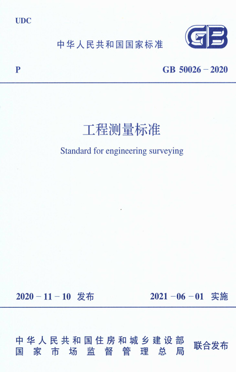
发布日期:2020-11-10
实施日期:2021-06-01
主编部门:中国有色金属工业协会
主编单位:中国有色金属工业西安勘察设计研究院有限公司,中国有色工程有限公司
主要起草人:王百发,王双龙,张潇,林鸿,徐亚明,胡大为,郝埃俊,刘广盈,洪剑,丁吉峰,杨雷生,石成岗,曹玉明,曾德培,常君锋,王树东,傅晓珊,史阿亭,何军,褚世仙
出版社:中国计划出版社
标准书号:155182·0701
出版时间:2021-02-01
本标准的主要技术内容是:总则,术语、符号和缩略语,平面控制测量,高程控制测量,地形测量,线路测量,地下管线测量,施工测量,竣工总图的编绘与实测,变形监测等。
本标准适用于工程建设领域的通用性测量工作。
根据住房和城乡建设部《关于印发〈2016年工程建设标准规范制订、修订计划〉的通知》(建标〔2015〕274号)的要求,标准编制组经过广泛调查研究,认真总结实践经验,参考有关国际标准和国外先进标准,并在广泛征求意见的基础上,修订了本标准。
本标准的主要技术内容是:总则,术语、符号和缩略语,平面控制测量,高程控制测量,地形测量,线路测量,地下管线测量,施工测量,竣工总图的编绘与实测,变形监测等。
本标准修订的主要技术内容是:
1.增加了对测绘软件的测试验证要求;
2.增加了卫星定位动态和自由设站控制测量方法,将原GPS拟合高程测量修订为卫星定位高程测量;
3.增加了地面三维激光扫描、移动测量系统、低空数字摄影、机载激光雷达扫描、多波束水域测深系统等数字测图方法;
4.增加了数字正射影像图和数字三维模型的技术要求;
5.增加了输电线路的交叉跨越和平断面测量等内容;
6.增加了管线要素分类与代码的规定;
7.增加了核电厂施工测量和综合管廊施工测量等内容,对隧道施工中的陀螺经纬仪定向技术进行了修订;
8.增加了自由设站、地面三维激光扫描、光纤光栅传感器和地基雷达干涉测量等基本监测方法,增加了核电厂变形监测和变形监测信息系统等内容;
9.对图根平面、高程控制测量进行了合并修订;
10.删除了方向观测法度盘和测微器位置变换计算公式,简化度盘配置要求。
本标准中以黑体字标志的条文为强制性条文,必须严格执行。
本标准由住房和城乡建设部负责管理和对强制性条文的解释,由中国有色金属工业协会负责日常管理,由中国有色金属工业西安勘察设计研究院有限公司负责具体技术内容的解释。执行过程中如有意见或建议,请寄送中国有色金属工业西安勘察设计研究院有限公司(地址:陕西省西安市西影路46号,邮编:710054)。
本标准主编单位:中国有色金属工业西安勘察设计研究院有限公司
中国有色工程有限公司
本标准参编单位:深圳市建设综合勘察设计院有限公司
广州市城市规划勘察设计研究院
长江空间信息技术工程有限公司(武汉)
武汉大学
中国电力工程顾问集团华北电力设计院有限公司
化学工业岩土工程有限公司
机械工业勘察设计研究院有限公司
中交第二航务工程勘察设计院有限公司
西北综合勘察设计研究院
中国能源建设集团湖南省电力设计院有限公司
建设综合勘察研究设计院有限公司
西安长庆科技工程有限责任公司
深圳市勘察测绘院有限公司
本标准主要起草人员:王百发 王双龙 张潇 林鸿 徐亚明 胡大为 郝埃俊 刘广盈 洪剑 丁吉峰 杨雷生 石成岗 曹玉明 曾德培 常君锋 王树东 傅晓珊 史阿亭 何军 褚世仙
本标准主要审查人员:李建成 刘东庆 田洪祯 付宏平 曹智翔 焦素朝 燕樟林 张周平 周国成 姜雁飞 张凤录
中华人民共和国住房和城乡建设部公告
2020年 第249号
住房和城乡建设部关于发布国家标准《工程测量标准》的公告
现批准《工程测量标准》为国家标准,编号为G B 50026-2020,自2021年6月1日起实施。其中,第5.1.10、5.3.51、5.7.5、7.1.8、7.5.14、8.7.15、10.1.10条为强制性条文,必须严格执行。原国家标准《工程测量规范》GB 50026-2007同时废止。
本标准在住房和城乡建设部门户网站(www.mohurd.gov.cn)公开,并由住房和城乡建设部标准定额研究所组织中国计划出版社有限公司出版发行。
中华人民共和国住房和城乡建设部
2020年11月10日
目录
中华人民共和国住房和城乡建设部公告
前言
1 总则
2 术语、符号和缩略语
2.1 术语
2.2 符号
2.3 缩略语
3 平面控制测量
3.1 一般规定
3.2 卫星定位测量
3.3 导线测量
3.4 三角形网测量
3.5 自由设站测量
4 高程控制测量
4.1 一般规定
4.2 水准测量
4.3 电磁波测距三角高程测量
4.4 卫星定位高程测量
5 地形测量
5.1 一般规定
5.2 图根控制测量
5.3 测绘方法与技术要求
5.4 一般地区地形测图
5.5 城镇建筑区地形测图
5.6 工矿区现状图测量
5.7 水域地形测量
5.8 数字线划图
5.9 数字高程模型
5.10 数字正射影像图
5.11 数字三维模型
6 线路测量
6.1 一般规定
6.2 铁路、公路测量
6.3 架空索道测量
6.4 自流和压力管线测量
6.5 架空输电线路测量
7 地下管线测量
7.1 一般规定
7.2 地下管线探查
7.3 地下管线施测
7.4 地下管线图绘制
7.5 地下管线信息系统
8 施工测量
8.1 一般规定
8.2 场区控制测量
8.3 工业与民用建筑施工测量
8.4 水工建筑物施工测量
8.5 桥梁施工测量
8.6 核电厂施工测量
8.7 隧道施工测量
8.8 综合管廊施工测量
9 竣工总图的编绘与实测
9.1 一般规定
9.2 竣工总图的编绘
9.3 竣工总图的实测
10 变形监测
10.1 一般规定
10.2 水平位移监测基准网
10.3 垂直位移监测基准网
10.4 基本监测方法与技术要求
10.5 工业与民用建筑变形监测
10.6 水工建筑物变形监测
10.7 地下工程变形监测
10.8 桥梁变形监测
10.9 滑坡监测
10.10 核电厂变形监测
10.11 数据处理与变形分析
10.12 变形监测信息系统
附录A 精度要求较高工程的中误差评定方法
附录B 平面控制点标志及标石的埋设规格
附录C 高程控制点标志及标石的埋设规格
附录D 建筑方格网点标石规格及埋设
附录E 建(构)筑物主体倾斜率和按差异沉降
附录F 基础相对倾斜值和基础挠度计算公式
本标准用词说明
引用标准名录
Contents
1 General provisions
2 Terms、symbols and abbreviations
2.1 Terms
2.2 Symbols
2.3 Abbreviations
3 Horizontal control survey
3.1 General requirements
3.2 Satellite positioning
3.3 Traverse survey
3.4 Triangular control nctwork survey
3.5 Free station
4 Vertical control survey
4.1 General requirements
4.2 Leveling
4.3 EDM-trigonometric leveling
4.4 GNSS-leveling
5 Topographic survey
5.1 General requirements
5.2 Mapping control survey
5.3 Plotting methods and technical requirements
5.4 Topographic mapping of general area
5.5 Topographic mapping of building area of the town
5.6 Survey of the current map of industrial and mining area
5.7 Topographic survey of water area
5.8 Digital line graphic
5.9 Digital elevation model
5.10 Digital orthophoto map
5.11 Digital 3D model
6 Route survey
6.1 General requirements
6.2 Survey for the railway and road
6.3 Survey for aerial cableway
6.4 Survey for gravity flow and pressure piping
6.5 Measurement of overhead power transmission line
7 Underground pipeline measurements
7.1 General requirements
7.2 Underground pipeline exploration
7.3 Underground pipeline survey
7.4 Underground pipeline mapping
7.5 Undcrground pipeline information system
8 Construction survey
8.1 General requirements
8.2 Field zone control survey
8.3 Industrial and civil building construction survey
8.4 Hydraulic structures construction survey
8.5 Bridge construction survey
8.6 Nuciear power plant construction survey
8.7 Tunnel construction survey
8.8 Municipal tunnel construction survey
9 Compilation general layout drawing and as-built survey
9.1 General requirements
9.2 Compilation general layout drawing
9.3 As-built survey
10 Deformation monitoring
10.1 General requirements
10.2 Horizontal displacement monitoring reference net
10.3 Vertical displacement monitoring reference net
10.4 Basic monitoring method and technical requirements
10.5 Industriat and civil building deformation monitoring
10.6 Hydrauiic structures deformation monitoring
10.7 Underground engineering deformation monitoring
10.8 Bridge deformation monitoring
10.9 Landslide monitoring
10.10 Nuclear power plant deformation monitoring
10.11 Data processing and deformation analysis
10.12 Deformation monitoring information system
Appendix A Evaluation method for mean square error of engineering with higher precision requirem ents
Appendix B Specification for mark of horizontal control point and burying monument
Appendix C Specification for mark of vertical control point and burying monument
Appendix D Specification and burying for monument of building grid points
Appendix E Formula for calculating tilt rate of building's (structure's)main body and formula for reckoning tilt value of main body according to differential settlem ent
Appendix F Formula for calculating relative tilt value of foundation and foundation deflection
Explanation of wording in this standard
List of quoted standards


